Collective Access and Critical Design: Walks and Talks along Onondaga Creek
Each year we bring national leaders in the field of adapted sports and inclusive recreation to Syracuse in order to foster innovation and inclusion in our community. We try to change up the format and venue each year. The Fit-In conference is archived on our website in order to reach a wide audience.
October 2016 – April 2017
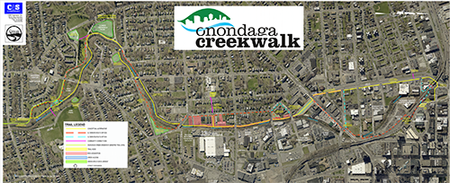
Aloft Hotel and Onondaga Creekwalk, Syracuse Inner Harbor , April 11, 2017
collective access + critical design
Walks and Talks along the Onondaga Creek Corridor
A workshop with Aimi Hamraie* to develop a network of accessible outdoor spaces
Tuesday, April 18. 11:00 — 1:30. Loft Hotel at the Canal basin
The workshop will explore a new vision for a landscape scale network of accessible outdoor recreation spaces. The goal is to develop design ideas for linking neighborhoods with the miles of public space along the Onondaga Creek Corridor and Onondaga Lake trail.
This is a trans-disciplinary collaboration with faculty and students from SUNY ESF Landscape Architecture and SUNY Upstate Medical University.
*The workshop will be co-lead by Aimi Hamraie, assistant professor at Vanderbilt University and director of the Mapping Access Project.
Hamraie’s interdisciplinary scholarship bridges critical disability, race and feminist studies, architectural history, and science and technology studies. Their publications include the forthcoming book, Building Access: Universal Design, Disability, and the Politics of Knowing-Making, and articles in Design and Culture, Disability Space and Architecture, and the Politics of Place and Space: Exclusions, Resistance, Alternatives.
Participants will develop visual and verbal narratives and a collective map that reveal the diversity of experiences of people who live along the Creekwalk including those with different embodiments, indigenous people, and New Americans. The overarching goal is to create a framework for collective, participatory, and critical design engagement to expand the scope and scale of accessible landscapes.
Walks & Talks: Fourth Annual Fit-In Conference from Bob Gates on Vimeo.
This year our conference will focus on accessibility and inclusion in our public parks, gardens, neighborhoods and other outdoor spaces.
In the coming months we will collect video/photo/audio recordings of “walks & talks” via Facebook/Fitness Inclusion Network. We will also archive the Walks & Talks on this “walks and talks” page.
Our guest speaker this year is Aimi Hamraie PhD, Assistant Professor of Medicine, Health, and Society at Vanderbilt University. She will join us in April, to review the walks & talks videos and to give us feedback about the project. Aimi Hamraie is a feminist historian and epistemologist whose work focuses on the intersections of disability and design, particularly Universal Design, assistive technology, and critical design. Hamraie works in the fields of critical Disability Studies, Science & Technology Studies, Design Studies, Critical Geography, and Feminist Epistemology.
Insights we gain from the “Walks & Talks” project will be used to create an accessible and inclusive Monday Mile loop at Kirk Park next year.
Our 4th annual Fit-In conference is a collaboration with Landscape Architecture students at the SUNY College of Environmental Studies and Forestry, Syracuse Department of Parks and Recreation, Syracuse University’s Lerner School for Public Health Promotion (Monday Mile initiative), and interdisciplinary students and faculty at SUNY Upstate Medical University’s Center for Bioethics and Humanities.
Nienke: Welcome, everyone, my name is Nienke Dosa and I think many of us already know one another.
Rebecca: And our guest here is Aimi Hamraie who is here from Vanderbilt University. Her special area of research is collective access and mapping strategies for access. Unfortunately we have a little access issue here. The hotel is scented which is a sensitivity for Aimi. That’s one of the reasons we have the fan running. I’m just trying to project for CART. So what you see there is what we’re talking about is being picked up by microphone and transmitted to the CART transcriptionist. Hi, Sally, it’s Rebecca. We just want you to follow along with everything here. So if someone can e‑mail me the link and try typing it in based on what’s on the website here. So you have to make that connection now.
So we can actually participate from the bench outside by following along CART. So it’s kind of amazing technological access.
Nienke: Okay, we have a perfect day for this because part of this is going to be indoors but a major portion is going to be spent walking outdoors as well and in the beautiful weather and not the scent issue outside so that’ll be good. I’m going to start by orienting you to what we’re trying to do today. So we’re going to be talking about collective access as this relate to the Onondaga Creek corridor and we have Russell here who is chief engineer for the Onondaga Creekwalk project. Yeah, and people from Syracuse parks. We’re going to go around and introduce ourselves. We have a lot of experts here and our goal is how this creek walk is an opportunity to promote inclusion and collective access.
- So we’re going to share insights from you all.
- Then I’m [Nienke Dosa] going to talk briefly about my perspective as a health care provider. Sort of a public health inclusion science perspective.
- Then Matt [Potteiger] will talk from the perspective of a landscape architect. He’s on the faculty at SUNY ESF.
- And then Aimi Hamraie is a disability studies scholar who will talk about collective access from her perspective.
Format:
- We are going to be talking for an hour
- Then we will be walking and lunch for the next hour and then
- We will reconvene and share our ideas on maps that we’ve placed on the table.
PARTICIPANTS TALK (INTRODUCTIONS):
She’s twelve years old. She’s my daughter. I am a health major and I brought her with me to see what her daughter does. She’s Sophia and my name is (speaker far from mic)
I’m a Syracuse University student and I’m here, I’m doing the culture competence class so I am learning more about that.
Good, and where do you go to school?Syracuse academy of science. Okay.
I’m (speaker far from mic).
I’m Marilyn (speaker far from mic) so I’m here to learn.
I’m Christopher Weiss and I work at the university as a counsel for building first generation houses.
My name is Glenn Willis, I work for the city of Syracuse. I work in the parks department. And I’m a planning officer for the parks department.
And I’m from families (speaker far from mic) school (speaker far from mic).
I’m a landscape architect and I’m on the faculty of (speaker far from mic) centers for community design research and I spend a lot of time on (speaker far from mic).
I’m Natalie (speaker far from mic) I’m third year master’s student for the (speaker far from mic) and I also live near (speaker far from mic).
I’m Gary, I’m an architect and (speaker far from mic) I work for fifteen years at the Syracuse school district and partly consult (speaker far from mic) in the past, though, I’ve, way back in the past, I’ve done some work on some university design, playgrounds and other related facilities.
I’m Russell and I’m (speaker far from mic) and working on the next (speaker far from mic) and after (speaker far from mic) focused on the route and the (speaker far from mic) next (speaker far from mic) improving accessibility.
I’m John, I’m with the city park and I’m part of the inclusion network. My emphasis is on inclusion and measurement of the built environment.
(Speaker far from mic) department of disability (speaker far from mic).
I’m (speaker far from mic).
I’m Peyton Sefick, I’m an athlete and I love nature so I’m really interested in the creek walk.
I’m (speaker far from mic) and recently I’ve been doing some research into the proposed extension of the creek walk and accessibility and access to the community so I’m excited to learn more about it.
I’m Jay Brenner I (speaker far from mic) always looking for fresh ideas and design.
I’m Rachel. I am very athletic and I start with a (speaker far from mic) very athletic.
I’m Chris, I’m Syracuse parks department and the last several years in the inclusion network to (speaker far from mic).
My name is Ann and I’m also with (speaker far from mic).
(Speaker far from mic) last summer I attended (speaker far from mic).
I’m Leah. I’m the assistant director with the Monday Mile program at the Lerner School for Public Health Promotion at the Maxwell School and one of our initiatives that we worked on collaboratively now for five years? Was city parks, county parks, inclusion network, healthy connections and our Monday mile initiative in creating accessibility (speaker far from mic) for recreation in Syracuse and surrounding counties.
I’m Mary and I work through healthy connection and through the (speaker far from mic).Do a lot of those (speaker far from mic) Madison County so here to learn.
I’m Nancy I’m from (speaker far from mic) and (speaker far from mic).See if I can identify any areas that may be (speaker far from mic) also just learning the (speaker far from mic). I appreciate you inviting us for this walk and Nancy works with (speaker far from mic) of a certain area and anybody from (speaker far from mic).
Hi, I’m Michele Pinto and I’m here to learn about accessibility mapping. I’m (speaker far from mic) and both of those have logging and accessibility is primary.
Jay and Ashley just came in and I don’t know if you want to mention something about what brings you here or ‑‑ okay. You live in, I think you live in the Onondaga ‑‑ near Onondaga Creek in that second phase so you’re from the neighborhood and I’m so glad you guys could join us and Ashley is with from interim health care, yeah. Thank you for coming. Really appreciate it.
NIENKE DOSA TALK:
Fitness Inclusion Network: Our mission is to develop innovative ways to support and develop inclusive fitness across the life span in central network. We host conferences. Our first conference was on power mobility. The second one was at WCNY. We brought in a stakeholders from the community and also a few national speakers to talk about ways to get people interested in access in our community. And Chris Abbott was there. So this was local agencies involved with adaptive sports and inclusive recreation and everyone had their five minutes on stage at WCNY studio so that was the second conference and our keynote was Eli Wolff a paralympic soccer player. The third conference was in adaptive design and that’s evolved into a really exciting ongoing project. We’re going to launch an adaptive design association here in Syracuse. With adaptive design we use low cost materials to make custom design solutions. And the fourth conference, in keeping with trying to be innovative and do things differently each year, is taking the format of small scale walks and talks and our community and we’ve recorded those with GoPro cameras and with drone videography and done some work with Matt [Potteiger] and his students walking and talking along the Kirk Park section of the Onondaga Creek walkway. And these “walks and talks” will be put on our website at some point so that we will share the landscape design ideas that were generated, we’ll share them.

There are excellent resources from the National Center for Health Physical Activity and Disability (https://www.nchpad.org/CHISP.pdf) on how to support inclusion as a community initiative. You can download this from the internet. And there’s a “How I Walk” campaign (https://www.nchpad.org/howiwalk) also from the National Center, and that’s available as a resource to us. They’ve developed a Community Health Inclusion Index(https://www.nchpad.org/1273/6359/Community~Health~Inclusion~Index) which is a way to assess the community and Mary, I think your group did some assessments. A couple years ago we used this assessment to look at the west side and we’ve also used an instrument developed at SUNY Cortland to look at accessibility of parks. Not just physical access but programmatic access and staff training. The Inclusion U training and Inclusive Recreation Resource Center (https://www.inclusiverec.org/inclusion-u-online) and that’s not just an assessment tool it’s also an interactive database for New York State. Jesse, Peyton, and a group of us have done some work looking at parks in the Syracuse area using that rating system and we’re working on a study comparing accessibility ratings for parks along the creek walk to disability rates in the census track along the creek walk. The take home message from this study is that our parks are accessible but the access ratings might be a little bit better in areas like Onondaga Lake Park where there are lower disability rates than in the south side of town where there are very high disability rates.
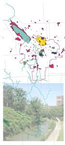
We also looked at the Inner Harbor area and the Onondaga Creekwalk using an open source mapping tool called Community Commons (https://www.communitycommons.org/ ). Community Commons is a website that gives you access to federal census data. It allows you to “map” population demographics and other characteristics. It is a useful tool for understanding health at the community level. So in the Syracuse area we looked at disability rates, you can see the creek walk area has some of the highest disability rates in our city. So we also looked at population by age, greater than 65 years old. 0‑4 age group. I’m just going to go through these really quickly. Median age. By census tract/ Ethnic diversity. By census track. Again, creek walk area, very ethically diverse. New Americans. North side has the highest rate of foreign born population. 32%. Hispanic and Latino populations.

This one is called, it’s a ‑‑ it’s called the vulnerable population footprint so the darker areas, the areas in town where more than 20% of individuals live below the poverty level plus more than 25% of individuals in those census tracks have less than high school education. So these are different public health perspective on our community and might inform the creek walk initiative.
Here’s another website I found. You can assess the walkability of your community. So Syracuse’s score is 60 out of 100. So we’re, I guess, that’s better than other places. And you can see in the more green areas of town, the areas that are more walkable so the downtown and university area. But also, you know, this Onondaga creek walk area. And the criteria would be able to walk to a grocery store or ‑‑ places that you need for day‑to‑day activities within five minutes. The ideal would be within five minutes and if it’s more than thirty minutes to walk there then you would get lower ratings. And then lastly, this is a map showing what percentage of the population that walks to work in our community. So that’s another perspective. Creek walk area would be 15%.
Okay, the fitness initiative. I was hoping Helena would be here. This is someone involved in one of our projects. That is three year grant that Kathy and John and a group of us have been working on. It’s an initiative to promote inclusive recreation for 18‑25‑year‑olds and you have the walking book and the geocaching book, those are projects out of that grant initiative. So Helena is probably your age. And she has quite a bit of dystonia. So she has a physical disability and she helped us with a project to highlight accessible outdoor areas, nature areas in Central New York. And this is the quote from her “nature’s great because it makes you feel free.” And I just love this picture because she’s so outward directed and so many of us with or without disabilities are always focused on phones and iPads and I just like the balance of that.
Glenn: My orientation and my perspective is that the city of Syracuse attempts to achieve the minimum standards when it comes to ADA access so I think that’s true of this routing. I think it’s true in parks. And one of the things for me when I ‑‑ I went to that west side assessment is how I met the standards, the minimum, federal standards for access to playgrounds and curb cuts and, you know, sidewalks with no tripping hazards, etc. And completed (background noise) and that was as if it were ‑‑ well, it was not inclusive. It’s a big contrast between meeting the minimum standard and meeting something that really makes it available for people and that’s not to speak of the programming.
Nienke: I think if we just hold that thought and the idea is to think about one purpose of this is to think about disability and access, universal design in an expanded scope, whether it’s legally mandated or what but just in terms of design objectives to think about accessibility in an expanded scope. That’s where we’ll kick off. And also this is an opportunity to be really creative and innovative.
And think positively.
MATT POTTEIGER’S TALK
So if I can repeat some of the objectives for this workshop, again, expanding scope and scale of accessible outdoor spaces. The first big idea here is that we’re, you know, we’re located right here but it’s part of a developing access network which is going to be miles and miles of access. From the Onondaga Creek corridor that links to loop around lake which still needs to be completed.
So this could be one of the most extensive accessible networks of outdoor spaces I can think of almost anywhere. So we’re going to think, you know, what that could be. And it’s really the process of understanding what that access could be in a collective sense too and that’s one reason we brought Aimi Hamraie here and we’ll go out and talk with her in just a couple minutes. And we’re going to experience the creek walk to experience a range of different ideas of accessibility and then we want to develop a framework for how we know about accessibility and a framework for mapping these experiences going forward as this corridor continues to be developed as they work on phase two of the creek walk. Okay? And we want to be able to identify some design opportunities what’s some potential? Again, a little bit of background on a process and in a way it’s ‑‑ we’re going to do this in miniature here today. My students this past fall, undergraduate students, worked with Nienke Dosa, and the Fitness Inclusion Network, a number of people in this room and we actually took a series of walks and talks. Fairly simple. We just walked different neighborhoods, some parts were in parks, some were along creeks and we had GoPro cameras and we just videotaped and talked.
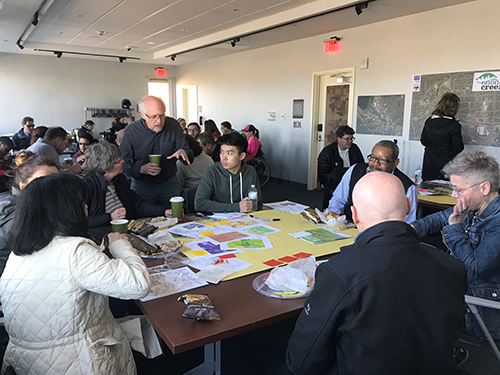
And we got people’s experiences from their direct point of view. And we asked the students who observed and developed and analyzed a conclusion out of those walks and talks. They also produced short little five minute videos which we don’t have time to show here but there is an example of some of that work. That’s what we’re going to do today is go out and walk the creek walk and get a range of experiences. And then we mapped those walks. We call them experiential maps. So we recorded the bright sun’s glare and someone sensitive that to glare and what that meant. Slopes. Inaccessible steps. We’re going to go in groups and walk and you’re going to take notes and we’re going to map. That’s what these big yellow sheets are for. We’re going to ask you to draw a map of your collective experience there. And then we applied this to a section of the creek walk that was being developed for one of the Monday mile walks. And so took that, those experiences and analyze the creek walk in those terms so this is looking at some of the ‑‑ sidewalk issues etc.
Some way finding and signage issues so this is just an example of some of the maps that the students produced and then we also did some proposals for how the creek walk could be, expanded accessibility. Including little detailed designs. This is a sketch where there’s a ramp that comes down but then it’s eroded below the ramp and how could you solve that problem with continued erosion. This was another one design ideas which was about numerous crosswalks which are not real visible for people and also not real visible for cars, especially coming down Brighton Avenue, etc. This is a proposal for really vivid crosswalk artwork ideas. And there we go. And forget the name of this but this was idea to get access to the open grassy areas on a temporary basis. And they used the idea of having coconut mats that you could use to get to the low cut grass areas.
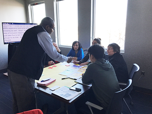
So we’re going to look at this particular stretch of the creek walk today and, okay, and as a preparation for doing that, we want to just take ‑‑ for you to take about, in your groups, take about five to ten minutes and look at what we know and how we know about the creek walk. Starting with this ‑‑ the mapping that was put together through the community commons. I’d like you to go through and look at these different maps and what do they tell you? What might they tell you about access along the creek walk? What issues they might flag or, what do we know from this? And you might also identify, well, maybe, what ‑‑ might we need to ‑‑ what more we might need to know. So there’s some sticky notes at the table. If you ‑‑ you can pass these maps around. Or one person in the table could be responsible just looking at one of the maps and just write these ideas about what these maps are telling us. It’s just a short exercise and then we’re going to go outside and talk with Aimi Hamraie about the idea of collective access and some experience and some other ways of knowing as well. Okay? And the whole idea of inclusion mapping. So if we could just take five to ten minutes within the groups to do that. Okay?
Hello, folks. Let me call your attention. I’m sure you haven’t exhausted all the ideas in these maps but in the interest of time; we’re going to move on the next step. These maps will still be here and you can still add to them over lunch. But what we are going to follow up with this mapping by going outside and talking with Aimi Hamraie who is, a lot of her work involves inclusion mapping and she’ll talk about the idea of collective access and kinds of different types of information too and other layers to add to maps like this. So we’re going to step outside here and we actually will go down, there’s a ramp over here, and down along the water here there’s an area with some benches but some folks can stand. And for those of you who want to have the CART access and text, someone out there, Rebecca is going to be typing a Word document and we can have you sit next to her and then see the text transcription of what Aimi’s going to be talking about so we’ll come back to this. But let’s actually step outside. We’re going to take a walk out on the creek walk and come back and review those experiences.
we’re going to organize into four teams. And each team is going to take a different topic and sort of a way of thinking about the creek walk here. The first team, we’ll call you the way finding, signage, language team so it’s about, well, how can you or other people find your way. What kind of signage is there? What other kind of clues are in the environment for the use, the direction? Okay, so that’s your topic.
The other group is how we move. All right? So that would be this middle group right here. It’s ‑‑ mobility. Various types of embodiments and mobility and different types of movements. Okay? So you’re making notes, experiences, and one is you’re thinking about yourself but you’re also trying to expand it. Think of other groups as well. So it’s a little bit of sort of speculating, okay?
And then the third group, which would be this group right here, it’s whose place is this? Who’s here, who is not here? Picking up on the demographing and thinking why are they not here and while we’re walking on this segment think of the broader demographics and whose place is the creek walk as it goes through different neighborhoods, different parts of the city.
The fourth group is an option to stay in this room. The category there is land use and history. The history of the land and the current use and how its use might reflect accessibility. We’re already raised the question about the seagulls and as a ‑‑ sort of contextual influence. There’s ‑‑ we know if there’s toxic sites around here, industry. So ‑‑ but there’s also a history of this land as well. And we have some references for folks to, you can look up some of that research. So that group, some folks can elect to stay in here and we have some website access for looking at the history. But it’s also experiential that you can travel and look at the context, the land uses, etc. So that would be this fourth group.
And so the idea is ‑‑ and we’re going to reconvene and draw a quick map of your experience and identifying the key points, key ideas. Okay? We’re all going in the same direction.
AIMI HAMRAIE”S TALK:
Field Notes taken by Rebecca Garden of Aimi Hamraie’s presentation and group discussion after our walk along Onondaga Creek at Syracuse’s Inner Harbor.


I’m a prof at Vanderbilt U also disability justice activist.
Want to describe space we’re in, we’re on the Creekwalk, body of water in direction where you hear seagulls.
Rebecca is typing transcript since we don’t have CART.
We are meeting outside because we are having access issues with the room. We are out here in fresh air for now.
Different approaches, building off of what was discussed this morning.
How to create disability maps to involve people in re-making space in inclusive ways.
You may be familiar with ADA and architectural guidelines. What are some examples of these?
(Confirming responses.) Curb cuts ramps sidewalk slopes, width of bathrooms for wheelchairs, Braille on elevators on signs.
The types of ADA criteria, minimal compliance to get to building and use pathway.
Disability activism: Beyond minimal compliance, Who is left out?
History of ADA, Congress negotiated and took categories out. Businesses objected, employers objected, too many categories and people.
Law is not the best standard.
You were looking at maps.
What disabilities were included in the categories on those maps:
Mobility barriers,
Language barriers? Not included.
Visual, usually included within certain parameters.
What are some disabilities that are not included:
cognitive, chemical, sensory, which can include sensory processing disabilities.
There’s something else about the maps: they don’t tell you about the built environment. People as dots not what’s happening with the space and environment.
We need to collect more data to have access information.
We need to move beyond individuals seeking access and moving to collective understanding of access.
Understanding disability as bigger category and also the way we approach disability and who is responsible. Is this individual’s personal responsibility to seek out accommodation or can we all take responsibility for collective.
For maps:
What data are we using? Whose included or not? Who collected data? People who have disabilities affected by environment should be collected as data. Can also be people who don’t identify as having a disability involved in that process. That’s good but important question is Who is the expert? People most affected should lead.
Bigger questions of what is disability? Who is responsible for creating access?
We will move through Creekwalk and have expanded notion of access as we do. What people are included and using the space as we observe?
We are going to talk about the history of this land, part of the Onondaga nation, what is this waterway and it is part of the nation.
Also who is here in Syracuse? How is signage providing or denying access through languages used?
Look at demographics, look at Creek/walk itself to observe and record.
Question: Universal Design goes way beyond ADA. Does common understanding of UD include the things that ADA does not.
Aimi H.: It can and should but needs to include race/class/gender and history. We need to do that work. Collect data that makes it possible for designers to take complete account of the space. That’s the way that it should be done. Get more accountability and inclusion.
Comment: Language, big concerns are words and language. Why is it CreekWALK if I use chair, have mobility issue?
AH: Great point, describes activities and how we imagine.
Comment: Aging population is not included in ADA and general approaches to inclusion.
AH: Good point, there are some rules but not directed at everyone.
RG: Question about how people who know that this space is for them. How do you get here and is it the hotel space?
Peyton: Found out about it through music performances announced on social media and that’s how he got connected.
AH: It’s good to know about the types of activities that can be here and can connect.
Comment: I don’t live far away from here. I go to the mall and just pass by here and didn’t know to come here. Wording is very important, should we say “FREE” and make clear that it is available.
Glenn: Noise of seagulls, picnic blanket and basket could end up in Alfred Hitchcock’s The Birds. Is it safe? Sighted person knows to move out of the way.
AH: How can we indicate this to people who are going to use this space.
Comment: whirligigs or other devices could create protected space.
AH: There are things about navigating the space as a blind person that I as a sighted person cannot know. You are here as an expert talking about that. We can all go out together and figure out what other things like that we need to know. Thank you.
AFTER THE WALK
AH; Quick wrap up. Could each group tell us one or two things?
Wayfinding Group: A lot of inconsistencies? What if I were a guest at hotel? Would not have been able to find. Pavement was uneven, inconsistent, does not indicate that it’s one path. Colors of signs were hard to notice, dull brown. Confusing letters and numbers.
AH: mobility and movement group:
Peyton: Largely all right, from a moving standpoint not too severe, a few bumps. Significantly less benches across the street. Overall movement was fine and clear. A bike went past and we noticed not much room for bikes and people walking/rolling.
Comment: Slight incline but there wasn’t a chair or seat at top. Signage talked about Inner Harbor but there was a hole in the pavers that the chair user would tip over into. Shrubs overgrowing into the sidewalk on the way back.
Peyton: Felt it promoted movement, including social movement.
Nienke: Last fall I walked that area by the Syracuse parks offices with two families with two young adults with autism. Elopement was a concern, concern about safety about running toward the water. My patients with autism may run away but they still need exercise. Suggest a track with fenced off area.
Comment: There are rails but who is responsible.
Nienke: Green space development next to walk could be fenced off.
Whose Place is it?
Stretch to Parks Dept. Not sure whose place it was, couldn’t hear or see the Creek. Couldn’t tell if it was public or private.
AH: How can we take this collected info and add it to a map to make it useful?
Glenn: Maps should have warnings about bridges and overpasses so that they aren’t so dangerous.
Cheli: Maybe on a map we could post and say “areas of concern,” reteaching that at a crosswalk, cars are supposed to stop.
AH;;How do you all think that people who live in Syracuse and are visiting or here for any other reason would use a map like that?
Comment; If I were a guest staying here I would want to know what else is in this area and how can I get there? What types of amenities are ther?
Comment: Distances, on bike or wheelchair? Useful to know how far?
Marin: As a visitor I also want to have a sense of safety.
AH: People who live someplace may collect information about where they do or don’t feel safe. Also in terms of accessibility and being taken into traffic.
Comment: I got my first dog 12 years ago…. Dog park….. Park may be safer with dogs, people there all year around.
Lakefront TNT Tomorrow’s Neighborhoods Today, Neighborhood Planning arm for city, 8 sectors. Lakefront TNT [this is Marin]. Michael Haggerty asked for funding to continue events for 6 weeks in the summer, pays musicians. Calls it Over Underpass, right along Creekwalk. Will fund publicity. Different people will mix and it will be accessible. Rebecca: Great if they could pay for transportation from neighborhoods where people don’t have cars.
AH: This relates to concern about safety. What are other dimensions of safety? If people are in a place creating culture around that place, it will create safety so that there doesn’t need to be increased policing, which could increase danger for some groups. Like Nienke was saying, creating community. Like Rebecca was saying: everyone should be able to access that space.
Thank you so much for the time and work that you did and I hope that these conversations will continue. Please send photos and videos.
Nienke: Has idea for follow up. Chad wants to meet at Webster pond next time. Maybe meet there next time?
Mary Lynn: People with peripheral vision issues are at risk with the lack of definition on the edges of the walkways.